Hydrology is the scientific study of the movement, distribution, and quality of water on Earth, including the water cycle, water resources and environmental watershed sustainability. Specific applications have traditionally arisen in urban drainage, measures for mitigating the effects of floods and droughts, water supply, water treatment, and coastal protection. Hydrology has evolved as a science in response to the need to understand the complex water system of the earth and help solve water problems.
Water is one of our most important natural resources. Without it, there would be no life on earth. The supply of water available for our use is limited by nature. Although there is plenty of water on earth, it is not always in the right place, at the right time and of the right quality. Adding to the problem is the increasing evidence that chemical wastes improperly discarded yesterday are showing up in our water supplies today.
The engineering hydrologist, or water resources engineer, is involved in the planning, analysis, design, construction and operation of projects for the control, utilization, and management of water resources. The work of our hydrologists is as varied as the uses of water and may range from planning multi-million dollar interstate water projects to advising homeowners about backyard drainage problems.
Hydrologists conduct the basic hydrology research that engineers apply to real-world problems. Their duties involve measuring properties such as stream volume and flow, collecting and testing water samples, evaluating the environmental impacts of pollution and natural disasters and predicting the future effects of water-related phenomena, such as erosion and sedimentation buildup. They are often asked to prepare written analyses of water project proposals for engineers and governmental bodies.
Hydrology is a discipline that incorporates sustainable water resource management, watershed modeling and fluid mechanics.
Hydrology / Hydraulics Projects
- I-49 RIVERINE FLOOD ANALYSIS:
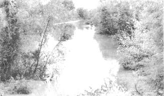
- BOGGY BAYOU RIVERINE FLOOD ANALYSIS: A master development plan for about 800 acres of their property which was traversed by Boggy Bayou was prepared. There were no previous determinations of expected flood levels in this largely undeveloped area. In order to prepare a meaningful master plan, appropriate Hydrological Engineering Center (HEC) programs were used and expected water surface profiles for 25, 50, and 100-year floods for several different scenarios. Suggested schemes for improvement of the bayou were considered in conjunction with scenarios for future development in the drainage area.
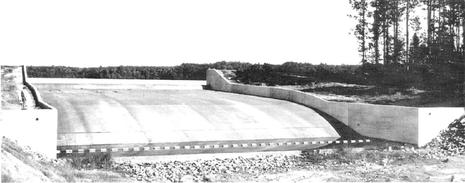
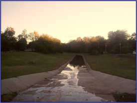
- LOWER CANEY LAKE SPILLWAY, OUTLET WORKS & ALTERATIONS TO DAM: Designed for the United States Forest Service, this was essentially a replacement for an existing inadequate and deteriorating spillway structure. An evaluation of the 1945 Spillway Design; Recommendation to Discard 1945 Design; Summary of Proposed Improvements; Design Flood Selection; Reservoir Area – Capacity Curves; Tailwater Rating Curves; Flood Routing Hydrograph; Stilling Basin; and Under-drain System. In order to provide adequate freeboard to accommodate the maximum flood discharge, it was necessary to raise the dam. Design criteria called for transportation of an incredible recorded storm (of 18.8 inches in 6 hours and a total of 23.8 inches in 12 hours) to this site from Hallet, OK. Although the drainage area is only 7.57 square miles, the transposed storm resulted in a spillway design discharge at maximum design flood stage of 6,225 cubic feet per second and a water depth of 5.75 feet above the spillway crest. The Ogee Crest Spillway, chute channel and stilling basin are all 120 fee wide. The total length of structure is 200 feet. The extremely sandy foundation soils required the utilization of sheet piling cut-off walls to underlying clay and an extensive under-drain system.
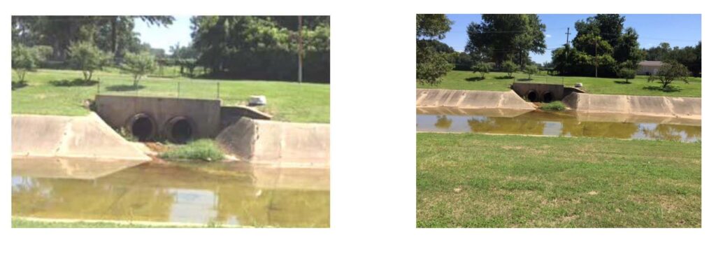
- COOPER BAYOU – BARKSDALE AIR FORCE BASE FLOOD CONTROL: Cooper Bayou, a tributary of Flat River, is situated entirely on Barksdale Air Force Base and is within the alluvial flood plain of the Red River. At its upper end, near Industrial Drive, it receives flow from Mack’s Bayou, Benoit Bayou, and Bossier Ditch as well as a number of other outfall drainage systems. Storm runoff from virtually all of Bossier City and most of the developed portion of BAFB adds to the flow. Cooper Bayou channel became increasingly inadequate to accommodate the flow and resulted in significant flooding in certain areas, particularly in the City. The Air Force planned improvements to alleviate the flooding. The scope of services for this project included surveys, bank stability analysis, hydrology, hydraulics design, construction plans and specifications, construction layout and inspection. The final project consisted primarily of enlargement of the channel, bridge adjustments and adjustments to local drainage facilities.
- BAYOU PIERRE CHANNEL IMPROVEMENT: Design Report for City of Shreveport, Channel bank stability between 70th Street to Bert Kouns Industrial Loop, a distance of 15,500 linear feet. Channel bank stability determination governed the recommendation for the improvement of Bayou Pierre and the impact upon adjacent land development. The report delineates the requirements of experience in the consideration of hydraulic and soil interaction in the determination/recommendation solutions to achieve soil bank stability.
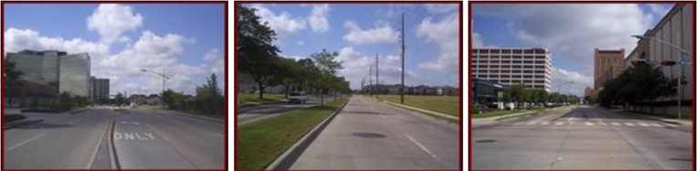
- SAGE RD. WIDENING: Widening of Sage Road to four lane plus median between Westheimer and Richmond for City of Houston/Harris County Transit Authority. Project incorporated not only improved drainage system, but also relocation of water, sewage and other utility systems. Maintenance of traffic for the Galleria during construction (especially during the holiday season between Thanksgiving and New Years) required close coordination with the Galleria Merchants’ Association to avoid glitches.
- BISSONET ST. IMPROVEMENTS: Rehabilitation of this concrete paved roadway between Kirby and Mandell (6,000 lf.) required close coordination with adjacent property owners and residents in the planning/design phases of development of construction plans for roadway improvement, drainage and utility relocation and maintenance of access to active commercial area as well as access to residential driveways.
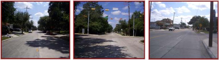
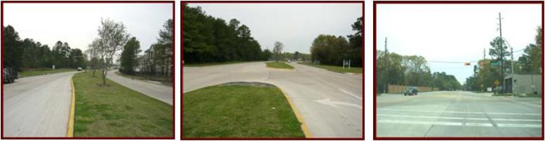
- HUFFMEISTER RD. IMPROVEMENTS: Improvement of Huffmeister Road for Harris County from a 2-lane asphalt pavement to a 4-lane concrete pavement roadway with medians. Project included a 60-inch dia. major drainage outfall, traffic signalization at Ravensway and phased construction to accommodate school access.
- BAYOU PIERRE CHANNEL IMPROVEMENTS AT QUERBES GOLF COURSE: Improvements to the Bayou Pierre Channel were developed for the City of Shreveport including two 72″ drainage lines at Querbes Golf Course. Project started at the intersection of Youree Drive (LA1) and Ardmore Ave. and continued down Ardmore to Greenway Place. Continuing along Greenway PL. for 500’, then turning to cut though a vacant lot to Querbes Golf Course, and paralleling Greenway Pl. to Bayou Pierre.