In land-use planning seeks to order and regulate land use in an efficient and ethical way, thus preventing land-use conflicts. Managing land-use can plan for the needs of the community while safeguarding natural resources. The systematic assessment of land and water potential, alternatives for land use, and economic and social conditions are necessary in order to select and adopt the best land-use options. Often a land-use plan provides a vision for the future possibilities of development in neighborhoods, districts, cities, or any defined planning area.
Our goal at PCDG is to help build sustainable communities that respond to their environmental setting, have strong neighborhoods, vibrant downtowns, and complete streets for present and future generations. Successful planning involves a balanced mix of analysis of the existing conditions and constraints; extensive public engagement; practical planning and design.
Current processes include a combination of strategic and environmental planning. We understand that any sector of land has a capacity for supporting human, animal, and vegetative life in harmony, and that upsetting this balance has dire consequences on the environment. Through research, design, and analysis of data, our planner’s work to create a plan for the community. This process involves gathering public input to develop the vision and goals of the community.
Corridor studies done as part of planning can help inform the various elements of the transportation decision-making process, such as defining the transportation deficiency or elements of the purpose and need, determining funding needs, or determining how corridor improvements fit into a larger system plan.
Transportation planning takes a comprehensive look at the natural, built, and social environments, and seeks to identify the long-term needs of the statewide transportation system to move people and goods. Transportation planning brings citizens, elected officials, and stakeholders together to make informed decisions about the future of a corridor and to propose and create an implementation plan for future investments.
The objective of a planning study is to meet the policy objectives of preservation, safety, mobility, environment enhancement, and stewardship to continuously improve the quality, effectiveness, and efficiency of the transportation systems. Effective planning produces useful information so planning decisions do not have to be re-evaluated during project development and scoping. The primary goal of PCDG is to keep people and business moving while improving the transportation systems.
Land & Corridor Planning Projects
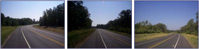
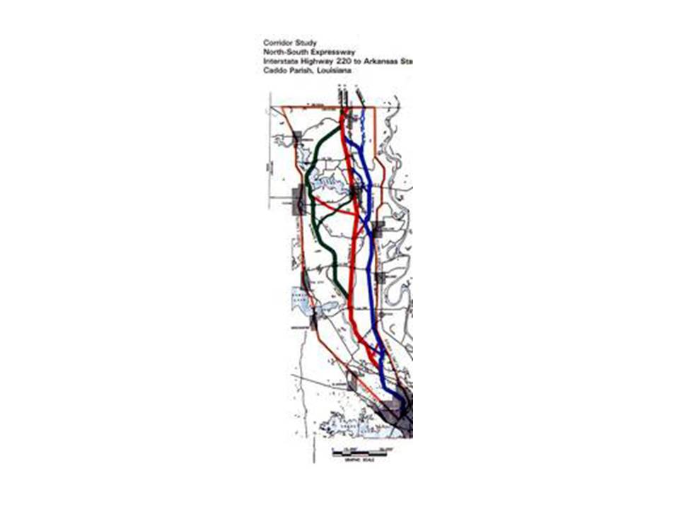
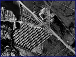
- NORTH SOUTH EXPRESSWAY: Corridor Study of the North-South Expressway between I-220 and the Arkansas State Line (I-49) for LaDOTD. I-49 was designated Corridor One under ISTEA transportation program as a part of the NAFTA economic development plan. This section of I-49 was the only segment without an approved alignment of Corridor One route. Purpose of Study was to identify environmental concerns, conduct a comprehensive transportation analysis which included projection of traffic demand and identify alternative corridors (each corridor was minimum 2000 feet wide), prepare line and grade study of each corridor. The study also included a Public Involvement Program to inform the public of the purpose and scope of the Study, to receive information, comments and concerns from residents within the study area and the general public within the affected area. Public meetings were held in the rural communities as well as within the City of Shreveport; coordinated location of the future I-49 roadway with Arkansas State Highway and Transportation Department to assure agreed location of future roadway.
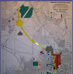
- CORRIDOR LOCATION STUDY UPDATE: Route I-20 – Route I-220 Highway in Caddo Parish, Louisiana for LADOTD.
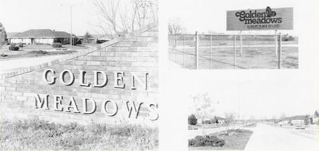
- GOLDEN MEADOWS SUBDIVISION
- SHADY GROVE SUBDIVISION
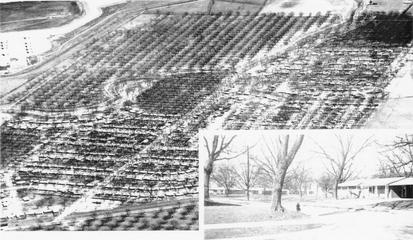
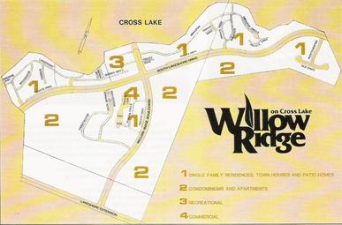
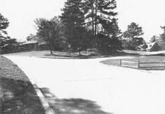
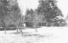
- WILLOW RIDGE SUBDIVISION
- RIDGEWOOD SUBDIVISION
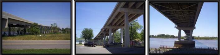
- US 84 BRIDGE: Project included Location Study, Environmental Impact Statement, conducted public involvement program design and prepared complete construction documents for new bridge structure (main span and approaches). Bridge design met all requirements to obtain permits for structure over Red River navigation channel.
- THE GALVESTON “Y”: Conceptual design/engineering and public involvement were included for the Galveston “Y” study. The purpose for improving the Galveston “Y” is two-fold: improve traffic flow due to projected traffic volumes indicating a need for additional lanes on IH45, SH6, SH146, and SH3 and to provide improved hurricane evacuation routes for Galveston Island and surrounding cities, villages, and islands. Based upon current TxDOT design criteria, the “Y” interchange had several design deficiencies; both horizontal and vertical geometry did not meet current design standards.
The first phase of work in the study process included the development of a data base: a land use study, identification of environmental concerns, a traffic study, and roadway capacity requirements were established. Three conceptual alternatives were studied in detail.
The preferred alternative maintained the interchange location but to constantly reconfigure to accommodate raising I-45 above hurricane main tide; modify SH3 and SH146 to a single connection with I-45 and alter ramp connection to SH6 and SH146. Wetland impacts were held to a minimum; mitigation required providing off-project wetlands to replace taking wetlands. This alternative also had the least construction cost. Construction phasing was planned to maintain traffic on IH45 during construction.
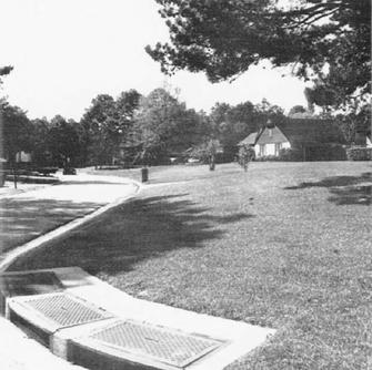
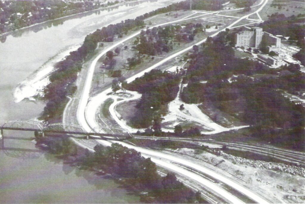
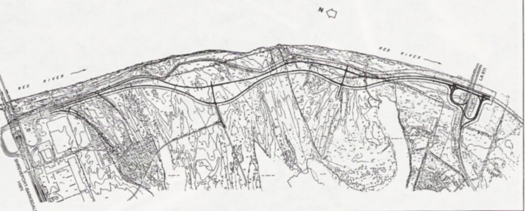
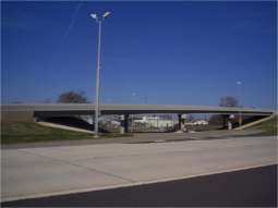
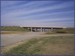
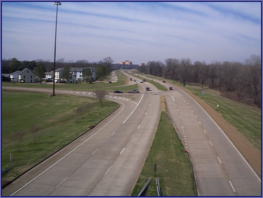
- CLYDE FANT PARKWAY: A Master Plan for the Parkway concept between Grimmett Drive to LA 511 was completed for the City of Shreveport. Construction was accomplished in 5 segments over a period of 20 years. The Parkway is a four lane divided by a varying median width except for the segment between Lake Street and Cross Bayou where the median is omitted.
An interchange is provided at Stoner, LA 3032 (Kings Hwy extended) and LA 511; a grade separation is provided to accommodate future planned development of the Parkway. Dredge material from Red River was utilized for approach fill for Stoner Avenue bridge structures.
- EAST / WEST OUTER LOOP (SOUTHERN LOOP): Master Planning; Line & Grade Study; Geometric Design; Drainage Design; and Right of Way