PCDG understands today’s transportation needs extend beyond planning for busy traffic, bad weather, or aging infrastructure. Long-term impacts to the environment must be considered. That’s why, in addition to our experience designing traditional modes of transportation, PCDG takes pride in its leadership in the design of Highways and Interchanges to assist communities in alleviating congestion and improving air quality. We also work with transportation agencies to upgrade and provide for future needs of existing facilities, as well as, determine the environmental impacts of projects and support them through the local, state, and federal permitting processes to keep projects moving forward.
Services for transportation engineering include:
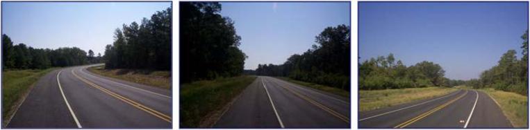
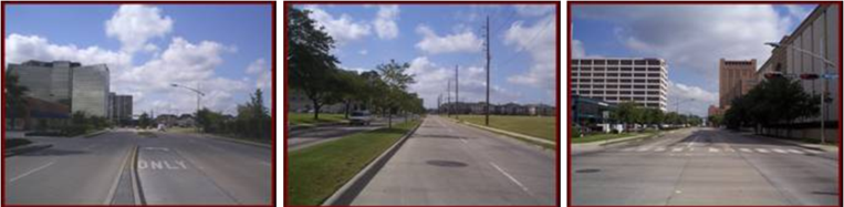
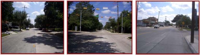
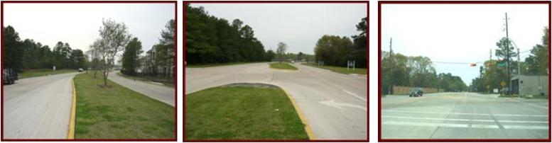
- Street and Roadway Design
- Route Studies / Schematic Design / Major Investment Studies
- PS&E Development / Major Roadway Design
- Bridge Design
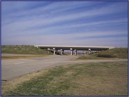
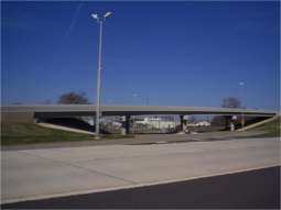
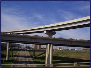
- Grade Separations and Interchange
- Pedestrians & Bike Facilities Design
- Open Channel Design/Culvert & Bridge Hydraulics
- Storm Sewer Design
- Traffic Control Plans / Signing and Pavement Marking
- Design-Build Concessions Projects
- Public, Private, and Partnership
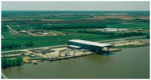
- Ports, Docks, Marine Design
- Airport Design
Our staff has extensive experience in all phases of freeway, tollway, rural highway and urban street design including feasibility studies, preliminary engineering, environmental clearance, construction documents, and right of way plans.
PCDG’s staff has also previously applied TxDOT requirements to numerous projects with other public clients such as Harris County Toll Road Authority, Harris County Public Infrastructure Department (HCPID), Houston METRO, and various cities and counties to enable federal/state funding to be used for their projects. The collective experience of the PCDG staff is represented in the firm’s TxDOT precertification categories (click here for TXDOT PRECERTS).
Transportation Projects
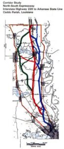
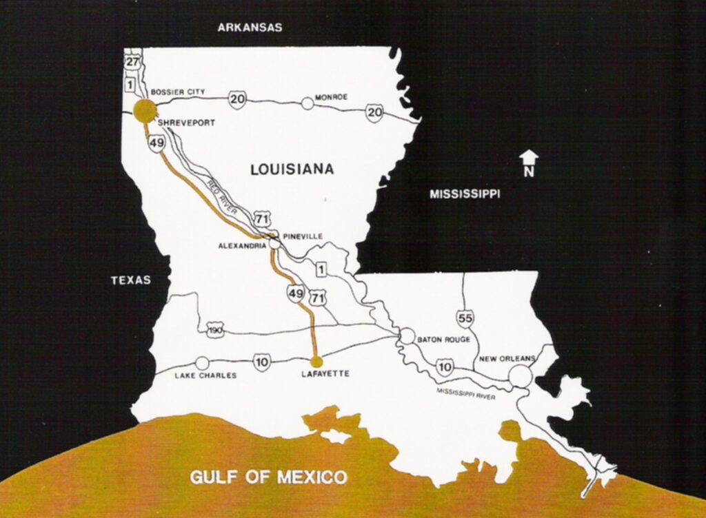
- NORTH SOUTH EXPRESSWAY: Corridor Study of the North-South Expressway between I-220 and the Arkansas State Line (I-49) for LaDOTD. I-49 was designated Corridor One under ISTEA transportation program as a part of the NAFTA economic development plan. This section of I-49 was the only segment without an approved alignment of Corridor One route. Purpose of Study was to identify environmental concerns, conduct a comprehensive transportation analysis which included projection of traffic demand and identify alternative corridors (each corridor was minimum 2000 feet wide), prepare line and grade study of each corridor. The study also included a Public Involvement Program to inform the public of the purpose and scope of the Study, to receive information, comments and concerns from residents within the study area and the general public within the affected area. Public meetings were held in the rural communities as well as within the City of Shreveport; coordinated location of the future I-49 roadway with Arkansas State Highway and Transportation Department to assure agreed location of future roadway.
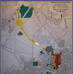
- CORRIDOR LOCATION STUDY UPDATE: Route I-20 – Route I-220 Highway in Caddo Parish, Louisiana for LADOTD.
- INTERSTATE I-49: The design of 3-5 mile rural segments as well as portion of urban segments in Alexandria and Shreveport, LA. Also provided were the right-of-way surveys, easement plats for four rural sections plus Shreveport urban segments between LA 526 to I-20 for other consultants assigned for design of those segments. Total design included three sections (approximately 17 miles) of Interstate Highway I-49 between Opelousas and Shreveport, LA.
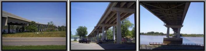
- US 84 BRIDGE: Project included Location Study, Environmental Impact Statement, conducted public involvement program design and prepared complete construction documents for new bridge structure (main span and approaches). Bridge design met all requirements to obtain permits for structure over Red River navigation channel.
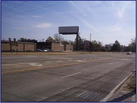
- MCDADE STREET WIDENING (La 3105): Preliminary, PS&E and right of way mapping for a 1 mile, four lane plus continuous turning lane to replace an existing 2 lane residential street in Bossier City, LA for LADOTD. Widening of McDade St. from 2 to 5 lanes and reconstructing the intersection of McDade St./Barksdale Blvd./Airline Drive. The project is designated as an extension of La.3105 (Airline Drive).
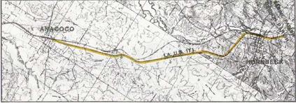
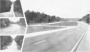
- LA-US ROUTE 171 ANACOCO TO HORNBECK: A line and grade study was developed for the improvement of 6.64 miles of LA-US Route 171 from Anacoco to Hornbeck, LA in Vernon Parish. Engineering services included: Traffic analysis; Evaluation of existing alignments and grades; Suggestion of improvements to the the existing two-lane roadway; Cost analysis; Preparation of plans and profiles of the required delineated horizontal and vertical alignments; Detail of examination of all curves in excess of 3 degrees; Hydraulic report; Roadway design; Bridge design; and Construction plans. Design plans for the upgrade of the existing two-lane roadway asphalt surfaced roadway to a four-lane divided roadway with PCC pavement were also developed. The existing 30-year old steel bridge structure over West Anacoco Creek was replaced with twin standard PCC slab span structures, 220 feet in length. Channel realignment and other replacement of other drainage structures were included in the final plans. Because the new alignment crossed the existing roadway at several points, detour plans, signing and phased construction plans were also necessary to maintain normal traffic during the construction phase.
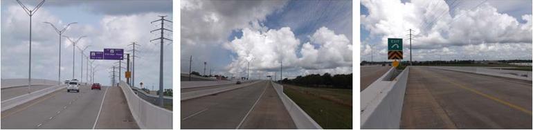
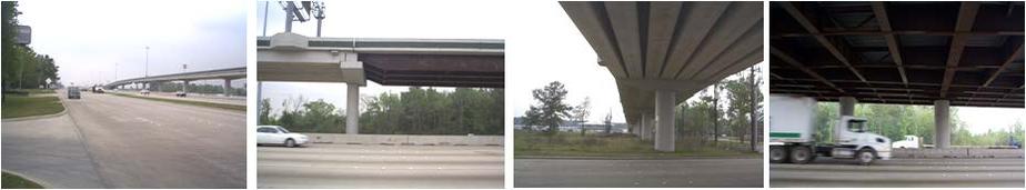
- WESTPARK TOLLWAY SECTION 2: Designed for the Harris County Toll Road Authority, it serves as an urban expressway. The project, 3,000 feet in length, consist of a four lane reinforced concrete pavement with concrete shoulders and a median barrier. The design also included a 303 foot three span bridge over Eldridge Parkway. The bridge consisted of a 117.00 foot center span and two 93.00 foot end spans all with Type IV AASHTO prestressed concrete girders. Included with the bridge was an exit ramp of 1,560 feet in length connecting with Westhollow Parkway. Also involved was a 1,440 foot realignment of Westhollow Parkway.
- KUYKENDAHL INTERCHANGE: The transitway interchange was constructed in the median of Interstate Highway 45 (IH-45) North to provide direct access to the Kuykendahl Park and Ride through an access ramp that connects the two facilities. The transitway interchange and access ramp is a part of the North Transitway segment from Beltway 8 to FM 1960. The Kuykendahl transitway interchange is approximately 8,000 feet and the access ramp is about 940 feet. The design of the structure was compatible with the design of main freeway lane widening, and transitway construction in the freeway median; freeway and transit interchange were constructed during the same period but under separate construction contracts. The Project included lighting improvements, drainage improvements, signage new and/or relocated utility services, and other improvements necessary to meet the operational/functional requirements of the project. Bridge construction has precast-prestressed concrete box girders, structural T’s of “weathering steel”, bridge deck is cast-in-place concrete with concrete barrier rail. Pier foundations are supported on drilled shaft concrete piers. Access ramp is portland cement concrete. Retaining walls are “reinforced earth” with precast concrete panels, steel reinforcing strips, mesh and steel connector rods.
- THE GALVESTON “Y”: Conceptual design/engineering and public involvement were included for the Galveston “Y” study. The purpose for improving the Galveston “Y” is two-fold: improve traffic flow due to projected traffic volumes indicating a need for additional lanes on IH45, SH6, SH146, and SH3 and to provide improved hurricane evacuation routes for Galveston Island and surrounding cities, villages, and islands. Based upon current TxDOT design criteria, the “Y” interchange had several design deficiencies; both horizontal and vertical geometry did not meet current design standards.
The first phase of work in the study process included the development of a data base: a land use study, identification of environmental concerns, a traffic study, and roadway capacity requirements were established. Three conceptual alternatives were studied in detail.
The preferred alternative maintained the interchange location but to constantly reconfigure to accommodate raising I-45 above hurricane main tide; modify SH3 and SH146 to a single connection with I-45 and alter ramp connection to SH6 and SH146. Wetland impacts were held to a minimum; mitigation required providing off-project wetlands to replace taking wetlands. This alternative also had the least construction cost. Construction phasing was planned to maintain traffic on IH45 during construction.
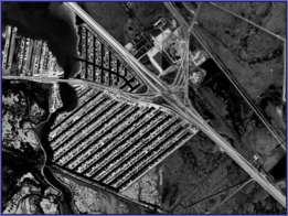
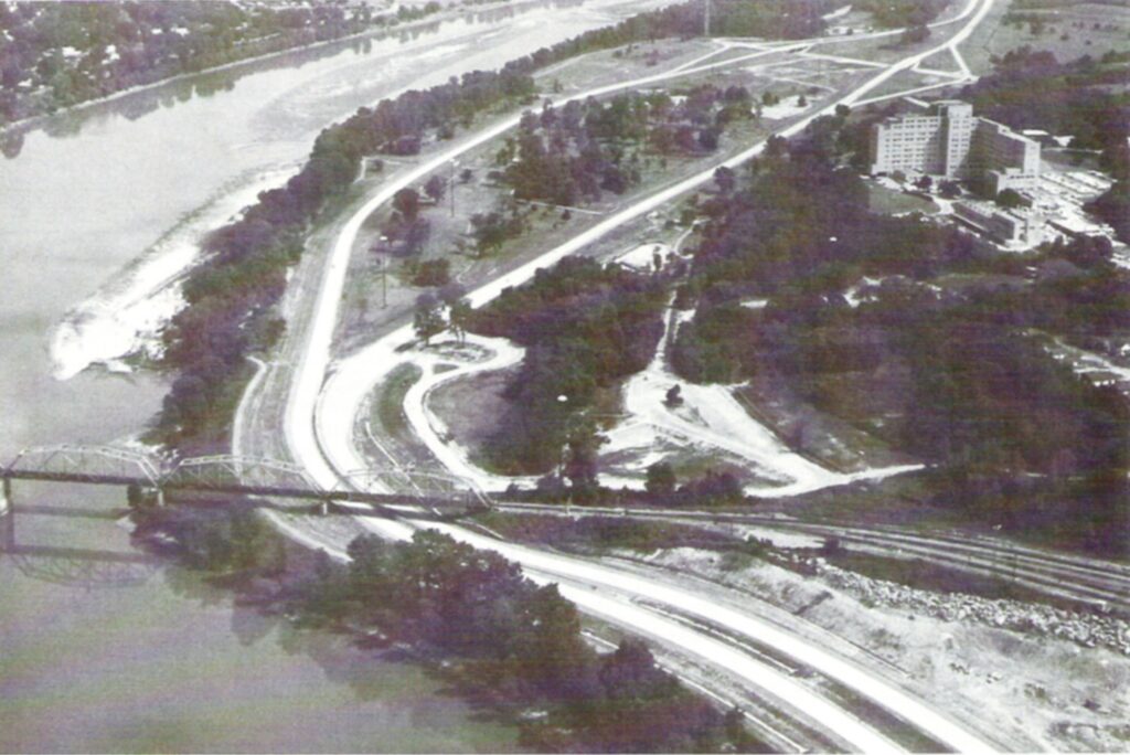
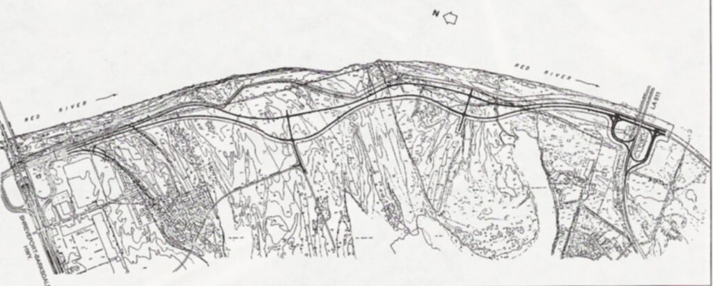
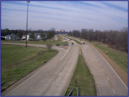
- CLYDE FANT PARKWAY: A Master Plan for the Parkway concept between Grimmett Drive to LA 511 was completed for the City of Shreveport. Construction was accomplished in 5 segments over a period of 20 years. The Parkway is a four lane divided by a varying median width except for the segment between Lake Street and Cross Bayou where the median is omitted.
An interchange is provided at Stoner, LA 3032 (Kings Hwy extended) and LA 511; a grade separation is provided to accommodate future planned development of the Parkway. Dredge material from Red River was utilized for approach fill for Stoner Avenue bridge structures.
- EAST / WEST OUTER LOOP (SOUTHERN LOOP): Services included: Master Planning; Line & Grade Study; Geometric Design; Drainage Design; and Right of Way
- SAGE ROAD WIDENING: Design of the replacement and widening of existing pavement of a major four-lane thoroughfare (2,300 l.f.) adjacent to the Galleria between Richmond and Westheimer for the Houston Metropolitan Transit Authority. Improvements designed included: (a) Design of a four-lane roadway with a median and four major intersections. (b) This project incorporated not only an improved drainage system, but also relocation of water, sewage and other utility systems. (c) Maintenance of traffic for the Galleria during construction (especially during the holiday season between Thanksgiving and New Years) required close coordination with the Galleria Merchants’ Association. (d) The signal system was designed (by others) is in accordance with requirements of the Uptown Houston Association; construction sequencing was arranged to keep the Galleria Mall accessible during business hours. (e) Design complied with AASHTO’s Policy on Geometric Design of Highway and Bridges, TxDOT’s Design Division Operations and Procedures Manual and Texas Manual of Uniform Traffic Control Devices for Streets and Highways.
- BISSONET IMPROVEMENTS: Replacement of existing street pavement on Bissonnet between Kirby and Mandell. Bissonnet included commercial properties as well as residences facing Bissonnet. Worked closely with the City Council representative of two active neighborhoods and a concerned commercial owner’s association to assure that maintenance of traffic access to properties would be available during construction and that all precautions would be instituted to minimize damage to existing trees, shrubs and other landscaped features.The traffic control plan and specifications for conduct of phased construction work was delineated to comply with not only citizens’ concerns but also the heavy traffic flow through intersections at S. Sheppard and at Greenbriar. The general contractor followed the plans with only minor modifications and completed the project within the designated time schedule.
- HUFFMEISTER RD. IMPROVEMENTS: Improvement of Huffmeister Road for Harris County from a 2-lane asphalt pavement to a 4-lane concrete pavement roadway with medians. Project included a 60-inch dia. major drainage outfall, traffic signalization at Ravensway and phased construction to accommodate school access.
- CADDO/BOSSIER PORT: The design services were for a working Port with a dock to support the ability to load and unload barges. Improvements were performed through a series of construction projects. The initial phase included a 600’cargo wharf, petroleum wharf, cargo storage w/ 50T crane, a stand-alone 30T crane, and railroad and roadway access.
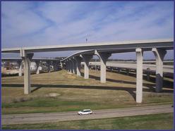
- I-20/SPRING STREET/MARKET STREET INTERCHANGE : This project restored two deleted traffic movements and eliminated the left lane exit movement with the addition of 2.4 miles of bridges and 0.4 miles of approach roadways. The specific movements involved were I-20 eastbound to La. 1 northbound, I-20 eastbound to Market Street south; Spring Street northbound to I-20 westbound.
This project required a comprehensive planning and design effort to develop acceptable construction phasing to minimize both local and through traffic congestion and to maximize safety during the expected three-year construction period.
All field surveys for design and right-of-way acquisition; all geometric design, all approach roadway design and design of the 3,561-foot bridge for the Spring Street northbound to I-20 westbound ramp; and all bridge widening designs and plans for the rehabilitation of two bridges were develop.
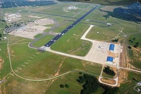
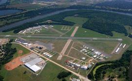
- SHREVEPORT DOWNTOWN AIRPORT IMPROVEMENTS: Prepared plans and specifications for strengthening runway 5-73, construction of new taxiway “H” and reconstruction of 450 feet of runway 14-32 and placing reflective pavement markings on taxiways and runway were developed for the Shreveport Development Authority. This project was FAA funded and required coordination with the FAA on all phases of work.